Origins of the Compass: How China's Navigation Technology Changed the World
The origins of the compass trace to Han dynasty China, not European sailors. It began as a divination tool and became the navigator's most essential instrument.
Read Wikipedia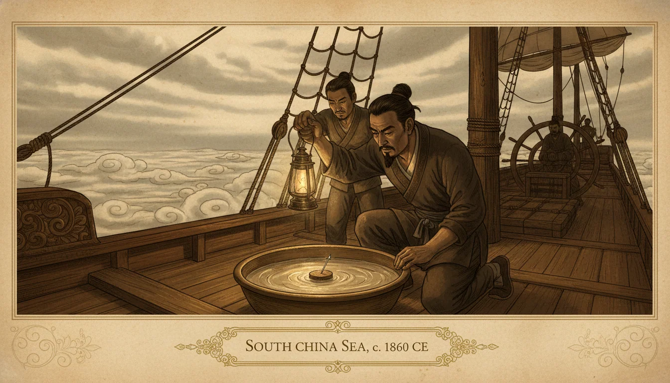
The story usually told about the compass involves European sailors. Sometimes it credits an Arab intermediary. Occasionally, a vague mention of Chinese origin appears before the account moves quickly to the Mediterranean and the Age of Discovery. The European voyage to the New World is where compass history is considered to matter, and so the instrument's six-hundred-year Chinese prehistory tends to get treated as a footnote to someone else's story.
That sequence is backwards. The compass was invented in China, refined in China, and used for Chinese purposes for centuries before any European text mentioned it. Understanding where it came from requires starting where it actually started, not where it eventually arrived.
Lodestones and divination
The core phenomenon is ancient and simple. Magnetite, an iron oxide mineral, sometimes occurs in a naturally magnetized form called lodestone. When a piece of lodestone is allowed to swing freely, it aligns with Earth's magnetic field. This property was noticed independently in multiple cultures, but the Chinese were the first to develop it systematically.
The earliest Chinese engagement with lodestones was not navigational. It was divinatory. The ancient Chinese practice of geomancy, the art of arranging spaces, burial grounds, and buildings in alignment with natural forces, required instruments for determining auspicious orientations. By the 1st and 2nd centuries CE, during the Han dynasty, Chinese geomancers were using a device called the si nan, the "pointing-south spoon." The device was a ladle shape carved or cast from lodestone, balanced on a polished bronze plate. The handle of the spoon, representing the Big Dipper constellation, would align to point south when the device settled.
The si nan was a divination tool, not a compass in any navigational sense. It did not go to sea. It was used to align graves and gardens and the rooms of palaces. But it demonstrated a clear Chinese understanding, centuries ahead of any other documented culture, that a freely suspended lodestone aligned reliably with the Earth's magnetic field.
The transition to the needle
The critical innovation was replacing the bulky lodestone spoon with a magnetized steel needle. A needle that had been rubbed on lodestone would retain a weaker but sufficient magnetic alignment. Needles were lighter, cheaper, and far easier to manufacture in quantity than carved lodestone implements.
The earliest Chinese text describing this application is a military encyclopedia called the Wujing Zongyao, compiled around 1040 CE during the Song dynasty. The text describes a "south-pointing fish," a thin fish shape cut from sheet iron, magnetized by heating and quenching in a north-south orientation, and floated on water in a bowl. The fish would align to indicate south.
A more precise description appears in the Dream Pool Essays of the polymath Shen Kuo, written around 1088 CE. Shen Kuo described rubbing a needle on lodestone to magnetize it, threading the needle through a rush fiber to float it on water, or hanging it on a single strand of silk so it could swing freely. He noted that the needle pointed slightly to the east of true south, a phenomenon now understood as magnetic declination, the difference between magnetic north and geographic north. Shen Kuo's observation of declination is among the earliest documented anywhere in the world.
By the late 11th century, Chinese mariners were using the floating-needle compass for navigation. The Pingzhou Ketan, a record from around 1117 CE by the scholar Zhu Yu, describes navigators using "fish needles" at night or in overcast conditions when celestial navigation was impossible. The compass was already a practical tool at sea before any European knew it existed.
The route westward
How the compass moved from Song dynasty China to 12th-century Europe is not definitively documented, and probably involved more than one channel. Arab traders operating in the Indian Ocean and South China Sea were in regular contact with Chinese merchants and had both motive and opportunity to adopt a navigation tool that worked. Persian and Arab geographical texts from the early 12th century describe instruments that may refer to the magnetic compass, though the references are ambiguous.
The first unambiguous European description appears in "De Utensilibus," a reference work written around 1190 CE by Alexander Neckam, an English cleric who studied and taught in Paris. Neckam described sailors using a needle mounted on a pivot, rubbed on a magnet, to determine direction when the stars were hidden. By this point the compass appears to have been in practical use on North Sea and Atlantic shipping, not a theoretical curiosity. Neckam describes it as a known practice, not an invention.
Shortly afterward, a French poet named Guyot de Provins described the sailor's compass in a poem written around 1206. The Italian Crusade chronicler Jacques de Vitry mentioned it around 1218. By the mid-1200s the dry compass, with a card marked with directions mounted on a pivot beneath a wind rose, was standard equipment on Mediterranean vessels.
This sequence points to a technology that entered European awareness sometime in the late 12th century and was absorbed into practical use within a generation. Whether it arrived from Arab intermediaries, from travelers on the Silk Road, or from the Byzantine world remains unresolved.
What it actually changed
The impact of the compass on European navigation is easier to assess than its origins. Before the compass, European sailors navigating the open Atlantic or in poor weather conditions relied on dead reckoning: estimating position based on known speed, heading maintained by reference to the stars or sun, and elapsed time. This method worked for coastal navigation and for well-established routes with predictable winds. It accumulated errors over long distances and failed entirely in overcast conditions.
The compass provided a consistent heading reference independent of visibility and celestial observation. A navigator who could not see the stars could maintain a course. A ship in fog near a rocky coast could determine whether it was heading toward or away from danger. The compass did not replace celestial navigation; it supplemented it, providing reliable directional data in precisely the conditions when the sun and stars were unavailable.
For the Atlantic crossings of the late 15th and early 16th centuries, the compass was not sufficient alone. The voyages of Vasco da Gama and Christopher Columbus required celestial navigation for latitude determination, accurate time-keeping for longitude estimation, and dead reckoning for short-term positioning. But none of those techniques could have been applied reliably in all weather conditions without the compass providing a consistent heading baseline.
The compass also enabled the development of accurate sea charts. Portolan charts, the coastal maps that began appearing in Mediterranean navigation in the 13th century, were constructed using compass bearings taken from known coastal points. Without consistent heading references, systematic charting of coastlines at the scale required for navigation was impractical. The compass made the chart; the chart made the voyage.
The Chinese contribution in retrospect
The history of the compass is a case study in what gets remembered and what gets overlooked when a technology transfers across cultural boundaries. The Chinese invented the instrument, refined it over centuries, and were using it for ocean navigation at least a century before any European mention of the device. They also observed magnetic declination before European users encountered the phenomenon.
What European users did, beginning in the 12th and accelerating through the 15th century, was integrate the compass into a broader navigational system, combine it with improved charting and astronomical observation, and deploy it in service of the specific geographic project of reaching Asia by sailing west. The outcomes of that project are too large and too mixed to describe simply as technological progress.
The compass itself is indifferent to history. A magnetized needle aligns with Earth's magnetic field today as it did for Shen Kuo in 1088, as it did for the Han dynasty geomancer turning his lodestone spoon on a polished bronze plate in a direction nobody has looked since. The physics has not changed. Only the story told around it has. For other technologies whose Chinese origins are routinely understated in Western accounts, see the origins of printing and the origins of the clock.
Quick Answers
Common questions about this topic
Who invented the compass?
The magnetic compass was invented in China. The earliest known form was the Han dynasty si nan, a spoon-shaped lodestone device used for divination around the 1st to 2nd century CE. The navigational compass, using a magnetized needle floating on water or suspended on a pivot, was developed during the Song dynasty and is first clearly described in Chinese texts around 1040 to 1088 CE.
When did Europeans get the compass?
The earliest European references to a magnetic compass are from around 1190 CE, in the works of Alexander Neckam, an English scholar. The compass appears in French and Italian sources in the early 1200s. It was in widespread use for Mediterranean navigation by the mid-1200s. How it reached Europe, whether through Arab traders, overland via the Silk Road, or independent rediscovery, remains debated.
Why does the compass point north?
A magnetic compass needle aligns with Earth's magnetic field, which runs approximately from magnetic south to magnetic north. The field is generated by the movement of molten iron in Earth's outer core. Chinese compass users noted that needles pointed south rather than north, and the instrument was historically called a 'pointing-south needle' in Chinese sources. North and south are arbitrary conventions; the physical fact is that the needle aligns with the geomagnetic field.
What did the compass actually change in navigation?
Before the compass, sailors navigated by the sun, stars, coastal landmarks, and dead reckoning based on estimated speed and heading. This worked reasonably well in clear skies near familiar coastlines. The compass enabled navigation in overcast conditions, far from land, and at night. It made ocean crossings that would otherwise be extremely dangerous into manageable undertakings, and is generally credited as one of the enabling technologies of the Age of Exploration.

Ask the Inventors Themselves
Chat with the people who were there when familiar things began.
Create your free account →No card required. Some figures and features require a paid plan.
Join the HistorIQly Club
Get smarter about the past.
Weekly stories, deep dives, and exclusive content straight to your inbox.